Lidar Software
Our Software
Lorem ipsum dolor sit amet, consetetur sadipscing elitr, sed diam nonumy eirmod tempor invidunt ut labore et dolore magna aliquyam erat, sed diam voluptua. At vero eos et accusam et justo duo dolores et ea rebum. Stet clita kasd gubergren, no sea takimata sanctus est Lorem ipsum dolor sit amet. Lorem ipsum dolor sit amet, consetetur sadipscing elitr, sed diam nonumy eirmod tempor invidunt ut labore et dolore magna aliquyam erat, sed diam voluptua. At vero eos et accusam et justo duo dolores et ea rebum. Stet clita kasd gubergren, no sea takimata sanctus est Lorem ipsum dolor sit amet.
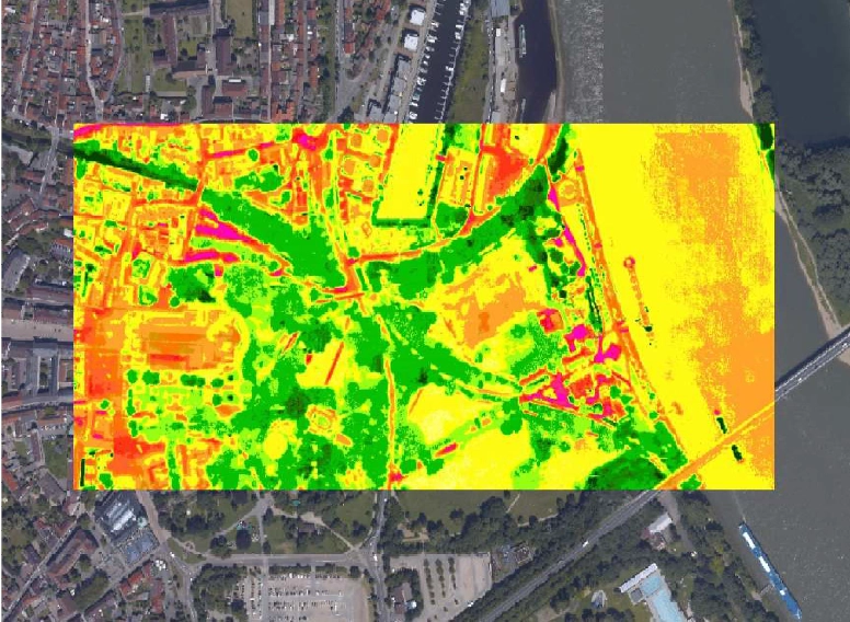
RiACQUIRE
Covers a wide variety of tasks RiACQUIRE covers a wide variety of tasks present in airborne laser scanning systems. Both, mobile and airborne systems comprise at least one laser scanner, a position and attitude measurement system, and an operator’s work station.
Many systems further comprise camera sub-systems, additional laser scanners, mass data storage devices, and mechanical subassemblies.
The tasks covered by RiACQUIRE are allocated to the operational data acquisition, the phases of system integration, and system verification & testing. An easy to use but powerful interface enhances communication with the supported RIEGL laser scanners. With the aim of reducing the work-load for the system operator, only the most relevant information is displayed and tasks can be executed semi-automatically. Scanning parameters are easily changed by choosing a predefined parameter set. The graphical user interface takes into account the difficult working conditions inside the aircraft, vessel or
vehicle by providing large control buttons, easily pushed even in turbulent conditions.
RiACQUIRE Main Features
- project-oriented scandata acquisition and scanner control
- online visualization of geo-referenced monitoring data during acquisition
- status feedback for fast recognition by the operator
- quality assurance with detailed history of events, system parameters and operator’s interactions
- use of flight plan information for automated acquisition (ALS)
RiACQUIRE Data Sheet
Here you can download the data sheet as a PDF file.
RiANALYZE
Full Waveform Analysis
Airborne Laser Scanners with full waveform capability digitize the waveform of the echo signal for every emitted laser pulse.
RiANALYZE applies the so-called Full Waveform Analysis to the digitized echo signals provided by the laser scanner and additionally transforms the geometry data (i.e., range and scan angle) into Cartesian coordinates. Thus RiANALYZE converts the digitized echo signal data to data compatible with conventional airborne laser data processing packages for further processing.
The output is a point cloud in the well-defined Scanner’s Own Coordinate System (SOCS) with additional descriptors for every point, e.g., a precise time stamp, the echo signal intensity, the echo pulse width, a classification according to first, second, up to last target.
Additionally, RiANALYZE is smoothly integrated into the project-oriented processing software RiPROCESS via the application RiSERVER.
RiANALYZE Main Features
- full waveform analysis of digitized echo signals acquired by RIEGL LMS-Q560, LMS-Q680(i), LMS-Q780, LMS-Q1560, VQ-780i, VQ-780 II, VQ-1560i, and VQ-1560 II
- extraction of an unlimited number of targets
- coordinate transformation into the scanner’s own 3D coordinate system
- enhanced performance using NVIDIA® GPUs, more than 10 times faster processing
RiANALYZE Data Sheet
Here you can download the data sheet as a PDF file.
RiHYDRO
Transforms the scan data into the coordinate system of the trajectory for smooth processing of scan data acquired with RIEGL Hydrography Laser Scanners the Airborne Data Processing Software AddOn RiHYDRO is offered as supplement to RiPROCESS.
When processing bathymetric laser data, additional processing steps have to be applied since both, the laser beam’s refraction at the air-water interface and the lower propagation speed within the water column must be taken into account in order to obtain a geometrically correct point cloud. Those specific processing steps – usually called „refraction correction“ – have to be carried out for each flight strip right after the standard ALS processing workflow.
Refraction correction of the points below the air-water interface (i.e. both points on the water bed and within the water column) requires a geometric Water Surface Model (WSM). WSMs can be generated from the laser data by one of the tools offered with RiHYDRO. An alternative option is to import already existing water surface models. In the first case, the water surface points must be classified before. For this task, a specific point classification tool in RiHYDRO is provided, which allows classifying the points on
horizontal water surfaces automatically.
The user can specify the index of refraction of the water and also a depth bias value to be taken into account during refraction correction.
RiHYDRO Main Features
- Automatic classification of water surface points
- Generation of a water surface model (WSM) based on classified water surface points
- Refraction correction of points below the water surface model (WSM)
- Support of different import and export formats for classification purposes
- Use point clouds from different scanners to identify water surface points
- Import externally generated WSM
- Processes a large number of files for unattended operation in batch mode
- Smoothly integrated into RiPROCESS
RiHYDRO Data Sheet
Here you can download the data sheet as a PDF file.
RiMTA
Covers a wide variety of tasks Acquiring data in laser scanning with high measurement rates over long ranges frequently results in range ambiguities. Instruments with multiple-time-around capability (MTA), include information in the acquired data which the RiMTA software utilizes to resolve these ambiguities. Instead of requiring users to manually specify the correct MTA zone for each data set or even subset of data, RiMTA automatically calculates the MTA zone for each measurement.
In order to correctly determine the range to a target with a LiDAR instrument using time-of-flight measurements with short laser pulse intervals, it is necessary to correctly determine the correlation of each received echo pulse to its causative emitted laser pulse. At high pulse repetition rates (PRR) and large target ranges this definite allocation becomes ambiguous due to a limiting factor which may not be tweaked by engineer‘s skills: the speed of light.
Today’s RIEGL LiDAR instruments provide extremely high measurement rates as well as long measurement ranges. In such cases, target echoes received may not necessarily be associated with the immediately preceding laser pulse emitted (MTA-zone 1). Instead they may be associated with any of the previous laser pulses emitted. Therefore it is necessary to correctly identify each pulse echo with its correct originating laser emission. This is automatically done by RiMTA in a smootly integrated data proseccing workflow.
RiMTA Main Features
- Automatic resolution of range ambiguity in time-of-flight ranging
- Unlimited number of MTA zones
- Smoothly integrated into the RIEGL data processing workflow
- Additonal note: processes data acquired with RIEGLlaser scanners with MTA-processing capabilities
RiMTA Data Sheet
Here you can download the data sheet as a PDF file.
RiPRECISION UAV
Covers a wide variety of tasks RiPRECISION UAV automatically performs adjustments of GNSS/INS trajectories to merge overlapping UAV-based RIEGL scan data. It further allows the scan data to be fitted to given control objects. This results in a consistent point cloud of enhanced precision and increased georeferencing accuracy.
To facilitate utmost performance RiPRECISION UAV is tightly embedded in RiPROCESS.
RiPRECISION UAV automatically conducts the whole workflow from scan data analysis to trajectory adjustment without any user interaction.
RiPRECISION UAV Main Features
- fully automatic adjustment of UAV-based RIEGL scan data
- handles multiple scan data overlaps
- optional adjustment to external control objects
- point cloud features accurately merged with trajectory quality information
- extremely fast and robust processing
- smooth improvement of both trajectory position and orientation
RiPRECISION UAV Main Applications
- Agriculture and Forestry
- Topography in Open-Cast Mining
- Terrain and Canyon Mapping
- Surveying of Urban Environments
- Archeology and Cultural Heritage Documentation
- Construction-Site Monitoring
- Corridor Mapping: Power Line, Railway Track, and Pipeline Inspection
RiPROCESS
Designed for managing, processing, analyzing, and visualizing data RiPROCESS is designed for managing, processing, analyzing, and visualizing data acquired with airborne laser scanning systems (ALS systems), unmanned laser scanning systems (ULS systems), and mobile laser scanning systems (MLS systems) based on RIEGL Laser Scanners. Data export in geodetic systems
is supported by the GeoSys Manager.
RiPROCESS is project-oriented and enables the user to manage all data acquired and processed within a single project. This data includes project data, scanning system information data such as mounting information and calibration data, laser raw data, e.g., the digitized echo signals from the RIEGL LMS-Q780 laser scanner, position and orientation data from the IMU/GNSS system, intermediate data files, search tree files for fast data access, and georeferenced point cloud data with additional descriptors for every measured coordinate.
RiPROCESS allows data export in the widely-used LAS format (amongst others) to execute common
tasks such as classification, triangulation and decimation by third-party software packages. The included GeoSys Manager offers a powerful tool for exporting the geo-referenced pointcloud in Carthesian ECEF, geographic and local grid coordinates. An interface to RiSCAN PRO, the accompanying software for RIEGL’s terrestrial 3D scanners, allows utilizing further visualization and pointcloud manipulation tools.
RiPROCESS Main Features
- project-oriented managing tool for processing of RIEGL airborne, UAV-based, and mobile laser scanner data
- operation in a multiple workstation environment, parallel task processing
- fast access to data for inspection in different visualization formats
- system calibration and scandata adjustment
- statistical analysis of referencing, matching quality
- interfacing to third party software packages
RiPROCESS Data Sheet
Here you can download the data sheet as a PDF file.
RiWORLD
Transforms the scan data into the coordinate system of the trajectory Airborne and Mobile Laser Scanning Systems provide data acquired by the laser scanner(s) and data from an INS/GNSS system. The laser scanner data is frequently referred to as scan data, whereas the INS/GNSS data or position and orientation data is called in short trajectory data after post-processing.
RiWORLD transforms the scan data into the coordinate system of the trajectory, usually WGS84 (world geodetic system). It thus provides the acquired laser data of the object’s surfaces within a geocentered coordinate system for further processing.
In order to transform the scan data with high accuracy RiWORLD applies accurate geometrical system descriptions as input, i.e., the transformations from the scanner system to the IMU/GNSS coordinate system, and to the vehicle body coordinate system. The output data of RiWORLD represents a point cloud in WGS84 with additional descriptors for each point such as amplitude of echo return, target reflectance,
echo pulse width, pre-classification, and more. RiWORLD is smoothly integrated into the project oriented processing software RiPROCESS via the application server RiSERVER.
RiWORLD Main Features
- transformation of laser data into the coordinate system of the trajectory
- interfacing to third party software packages
- smoothly integrated into RiPROCESS project management software
RiWORLD Data Sheet
Here you can download the data sheet as a PDF file.
Let’s have a look at our other products
Our products combine many years of know-how with precise crafts – manship and compliance with existing standards.
Aerial Cameras
LIDAR Scanning
GNSS-INS Devices
Software
Knowledge Center
You want to look deeper into details? Looking for applications with our technology? In our virtual library you find scientific papers, case-studies, webinars, brochures to download and many more.
