GNSS Post Processing
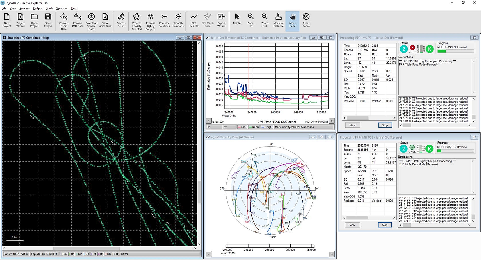
NovAtel Inertial Explorer
Inertial Explorer (IE) maximises the performance of your GNSS+INS hardware by processing and outputting a truth trajectory with the position, velocity and attitude accuracy your application requires. The tightly coupled integration of GNSS and inertial data delivers precise results, even when using lower-grade inertial sensors.
IE provides a source of truth for post-mission position, velocity and attitude trajectories for a range of applications, including mobile mapping, aerial and hydrographic surveying, R&D companies developing autonomous systems and post-processing-as-a-service integrators. With full support of major constellations, frequencies and GNSS corrections processing, IE ensures your data are reliably precise no matter where in the world you operate.

Features
IE fully supports major constellations and frequencies, including GPS L1/L2/L5, GLONASS L1/L2, BeiDou B1I/B2I/B3I/B1C/B2A, Galileo E1/E5a/E5b and QZSS L1/L2C/L5
Support for up to 32 base stations in each project
Boresight module for angular offsets between inertial measurement unit (IMU) and vehicle or camera frames
Boresight computation between the IMU and vehicle frame for users requiring attitude output relative to the vehicle frame
Estimate or refine lever arm offsets between IMU and GNSS antenna
Loosely and tightly coupled GNSS+INS processing
Differential GNSS – also known as post-processed kinematic (PPK) – and Precise Point Positioning (PPP) processing
Flexible Export Wizard outputs results at any vehicle location in the required data format, rate and coordinate frame
Direct output to Google Earth, RIEGL POF/POQ, DXF and SBET format
HTML quality control reports
Support for various third-party GNSS+INS products and generic data formats
scan data storage on internal 1TByte SSD MemoryEasy integration with SPAN GNSS+INS technology products
NovAtel Inertial Explorer Technical Specifications
Here you can download all technical specifications as a PDF file.
GNSS Post Processing
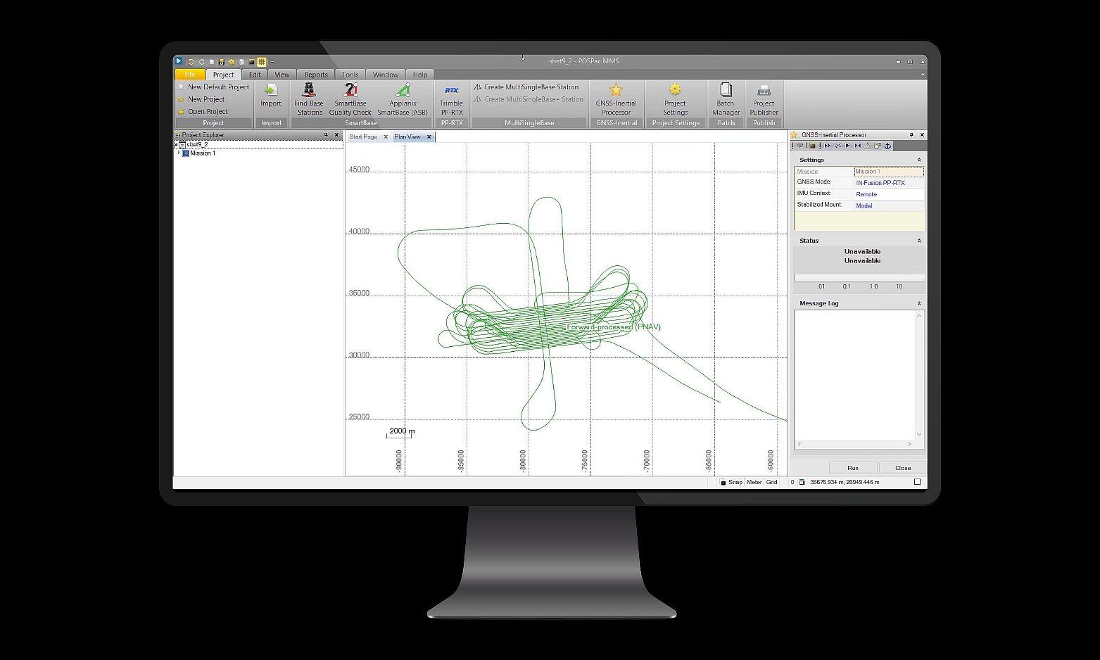
Applanix® POSPac MMS™
Applanix® POSPac MMS™ (Mobile Mapping Suite) 9 is Trimble’s next generation of industry leading GNSS-Aided Inertial post-processing software for georeferencing data collected from cameras, LIDARs, multi-beam sonars and other sensors on mobile platforms. Applanix POSPac MMS is optimized for all environments and platforms (air, land, marine) and compatible with a variety of mapping sensors. This smart software solution achieves both, maximum accuracy and efficiency for Direct Georeferencing. The cloud based version of Applanix POSPac is available and supports data from crewed airborne, uncrewed airborne and mobile mapping missions. The interface to the cloud service is via API and all POSPac desktop functionality is supported in the cloud.

Key Features
Post-Processed Trimble CenterPoint RTX trajectory processing (PP-RTX/ PPRTX 2)
Automatic base station survey using static RTX Survey In function
IN-Fusion+ – the new engine for Mobile Mapping or UAV data
Network License Support – share a single license across a network
nitialize without GNSS (in DeadReckoning) incl. PFix Support
LiDAR QC Tools for boresight calibration and trajectory adjustment
Windows 11 support
“Direct
Batch Processing for automation and higher productivity
Term License (annual) to reduce upfront cost
Applanix® POSPac MMS™ Technical Specifications
Here you can download all technical specifications as a PDF file.
Let’s have a look at our other products
Our products combine many years of know-how with precise crafts – manship and compliance with existing standards.

Aerial Cameras

LIDAR Scanning

GNSS-INS Devices

Software
Knowledge Center
You want to look deeper into details? Looking for applications with our technology? In our virtual library you find scientific papers, case-studies, webinars, brochures to download and many more.
